Did you know that a network of hidden waterways flows silently beneath the town?
This is the result of centuries of growth in Reading Borough, covering over what were once open streams, fishponds and waterways.
The first published map of ‘Redding’, produced by Speed in 1611, clearly shows a network of open streams and ditches in the south of the town. It also gives a fascinating insight into Reading’s size, which was then of only a few thousand people.
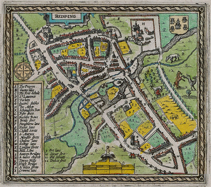
Speed's map of 1611, the first map produced that shows Reading.
One waterway — still flowing beneath Reading today — is the Holy Brook. This a channel of the River Kennet that leaves the river through a brick structure known as the ‘Arrowhead'. It travels for six miles from Theale, and once powered the mill of the Cluniac monks of Reading Abbey.
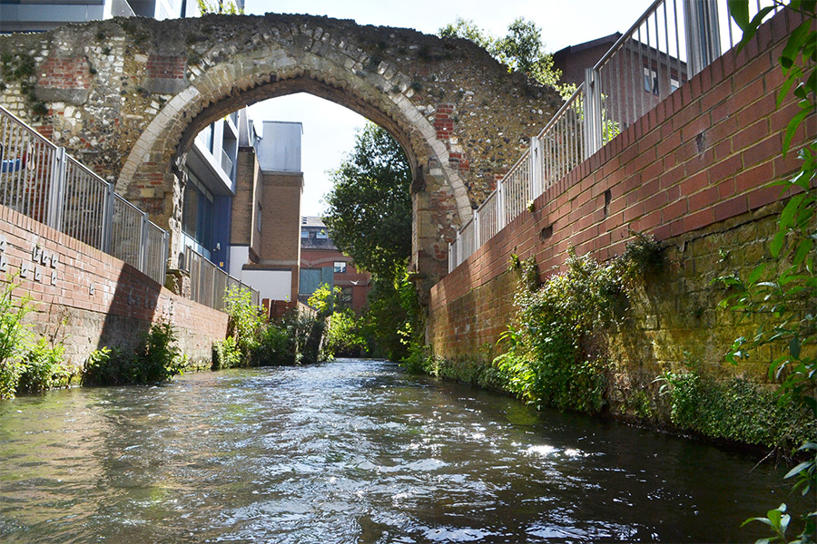
The Holy Brook beneath the old arch of the Abbey mill (photo credit: Chris Forsey).
The Holy Brook was the most northerly of the town's streams, and was crossed by four bridges of varying size. Two were minor footbridges, and they were eventually covered over by the town’s expansion.
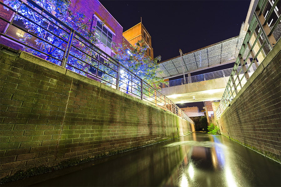
The Holy Brook flowing by the Oracle shopping centre (photo credit: Chris Forsey).
Reading’s population was served by at least five corn mills. The biggest of these was the old St Giles' Mill, which had previously been recorded in the Domesday Book.
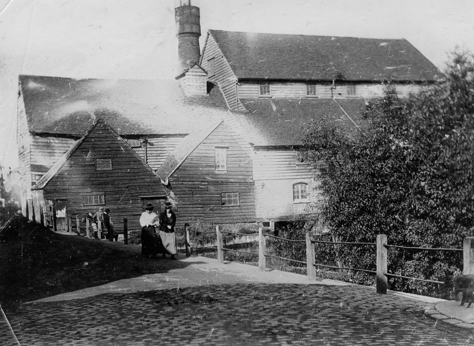
St Giles Mill, Reading in about 1900 (museum no. 1997.150.198)
St Giles' was the last mill in Reading to be demolished; in 1900, it made way for a tram depot, which then made way for the Oracle shopping centre in kind!
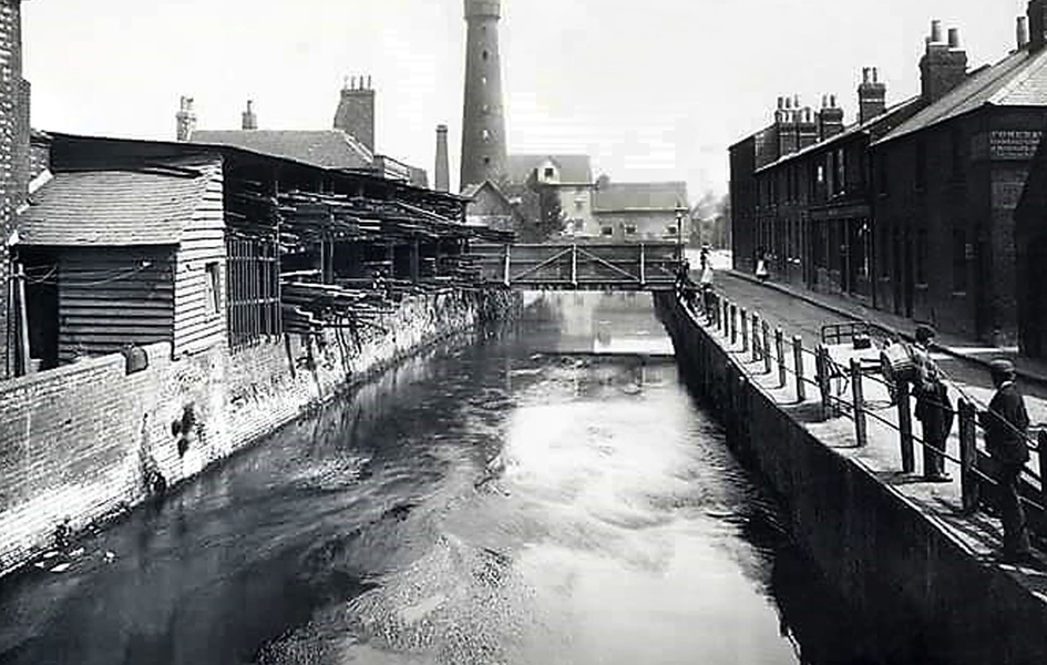
Mill Lane, Reading in 1900
Nearby Bridge Street was vital to anyone travelling into the heart of Reading, as its former name ‘Seven Bridges’ implied. However, these were wooden structures, and after the dissolution of the monasteries by Henry VIII, many of them were poorly maintained. Feeling guilty for the town’s plight, Queen Elizabeth I later authorised some restoration of this infrastructure, ironically using ribbed limestone blocks and pillars from the Abbey!
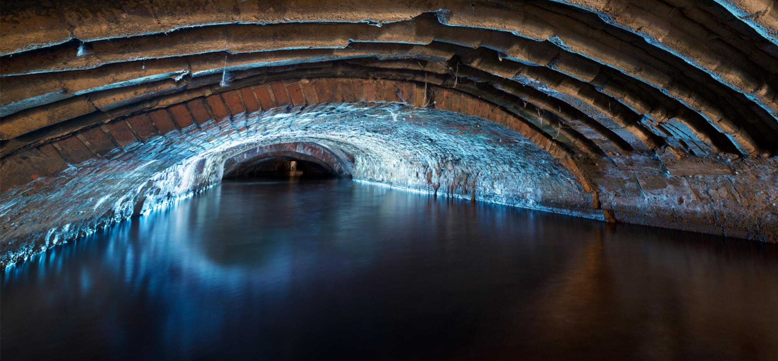
Several of these ornate pillars remain hidden beneath Castle Street and are Grade II listed, attesting to the fine workmanship of the medieval stone masons.
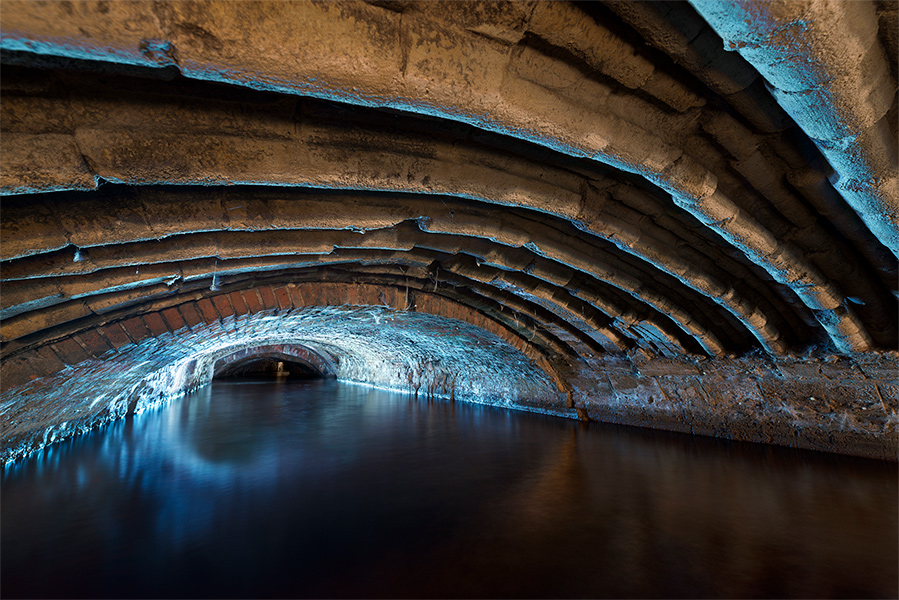
The remarkable hidden stonework reused in the Holy Brook culvert roof (photo credit: Mark O’Neill).
Part of the Kennet is also hidden from view. The original ‘leet’ – a channel dug to power the corn grinding wheels for St Giles’ Mill – still flows beneath the Mill Lane area. This was originally on an ‘island’, but is now hidden from view.
During the Civil War and the Siege of Reading in 1643, this entire area was flooded to serve as a line of defence for the town’s besieged Royalist garrison. There were also a series of ditches to the north of Reading, filled with the waters of the River Thames and denying Parliamentarian forces an easy route into town.
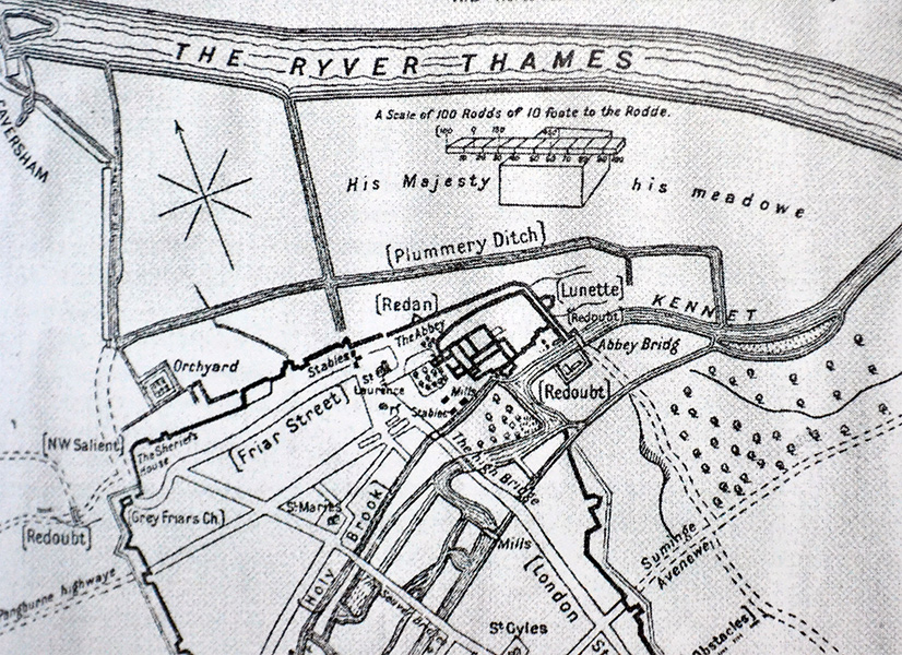
A map of Reading in the Civil War.
The largest of these ditches was the Plummery Ditch. It started in Kings Meadow (known at the time as ‘His Majesty’s Meadowe’), flowed eastwards and joined the Kennet near Blake’s Lock.
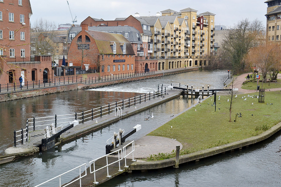
Blake’s Lock dates back as far 1404. The first written mention records that each vessel paid 1 penny to pass through. At this time the waterway connected Reading Abbey to the river Thames via Kennetmouth.
Blake's Lock (photo credit: Chris Forsey)
The Kennet and Avon canal did not join up to this waterway for another 300 years, when civil engineer John Hore of Newbury constructed three further locks. Within Reading Borough, there are a total of four locks today: from west to east, they are Southcote, Fobney, County and Blake's Lock.
Farthest west in the Borough is Southcote Lock, which was built between 1718 to 1723 (as were Fobney and County). Adjacent to it in the 18th century, a wire mill and pumping station supplied Reading with its first filtered water supply.
Fobney also has a pumping station which is used to adjust water levels as it has the largest rise and fall of over 7 feet.
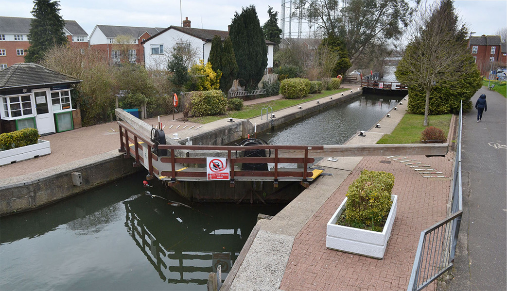
County Lock in the town centre has the lowest change in water levels but is the trickiest to navigate, especially around the 'Brewery Gut' which was formerly the site of Simond's Brewery.
An ingenious method of pulling boats through this area was devised (as no towpath existed), which consisted of floating a tow rope downstream and then pulling the vessel through.
County Lock (photo credit: Chris Forsey)
During the Second World War, it was thought the bridge, which carried traffic up and down Bridge Street, would not be able to withstand the heavy military vehicles passing over, so a series of strengthening steel girders and wooden railway sleepers were placed beneath. This made it almost impossible to navigate all but the smallest of boats underneath. However, the problem was later solved by installing a 'traffic light' system at either end of the area.
Next time you go for a walk through the town, think about the waterways flowing beneath you, and the rich history coursing through them.
Words and photos by Chris Forsey and Mark O’Neill, who photograhed the incredible images of the Holy Brook. Find more of Mark's work on his website, Facebook, and Instagram.
Find out more about the history of the town by exploring the Reading Museum blog. Alternatively, immerse yourself in local history by exploring our online collections.