The Oxford Road has always been one of the main routes leading west from Reading's medieval town centre towards Pangbourne and Oxford.
Until the early 19th century, the road ran through open agricultural land. These fields were developed for housing throughout the 1800s, at first as an elegant suburb for members of the town’s elite, and later with infill streets of terraced housing for the employees of Reading’s new manufacturing industries that arose after the arrival of the railway in 1840.
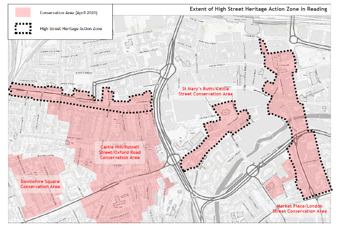
Today, these Georgian and Victorian brick-built terraced houses contribute to the Oxford Road’s distinctive urban historic character. Many of the terraces are listed buildings and form part of the extensive Castle Hill/Russell Street/Oxford Road Conservation Area. This conservation area (particularly the part of the Oxford Road stretching from the town centre to Reading West Railway Station) forms part of Reading's High Street Heritage Action Zone, which was announced in September 2019. More information about this can be found at the end of this article.
In this blog, join us as we explore the history of the Oxford Road. One of Reading’s most cosmopolitan neighbourhoods, it is home to families and individuals who can trace their ethnic roots to all corners of the globe. We focus particularly on the stretch of the Oxford Road between the town centre and Reading West Railway Station.
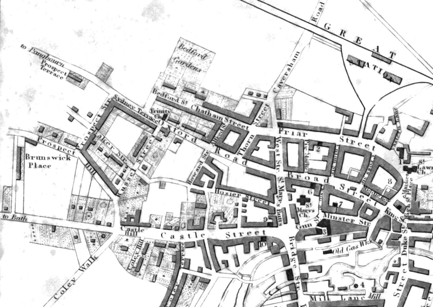
Oxford Road on John Man's 1813 map of Reading, showing the fields and market gardens before housing development started
1066 and All That - Battle and Reading's Early History
Until the area’s development in the 19th century, much of the agricultural land along the Oxford Road was part of Battle Farm. The origins of this name are key to understanding Reading’s earliest history.
Reading was first mentioned by name in 871AD, when the Viking army set up a fortified winter camp in the area where Reading Station and the Forbury Gardens are now situated. Frequent Viking raids continued to occur, the last known one being in 1006, when a Saxon nunnery thought to have been sited at St Mary’s Butts was burned to the ground.
By the time of the Norman Conquest in 1066, the part of the Reading now taken up by the Oxford Road was farmland owned by an Abbess called Elveva, probably of the same nunnery.
By 1071 the new Norman king, William the Conqueror, had taken the nunnery’s land and given it to his newly founded Battle Abbey at Hastings, which he had built to commemorate his victorious battle there. This connection with Battle Abbey is still remembered in the local place names - Battle School, Battle Library, and the former Battle Hospital on the Oxford Road. In 1121, William the Conqueror’s youngest son, King Henry I, founded Reading Abbey and the estates attached to Battle Abbey were soon recovered and given over as an endowment to his new Abbey.
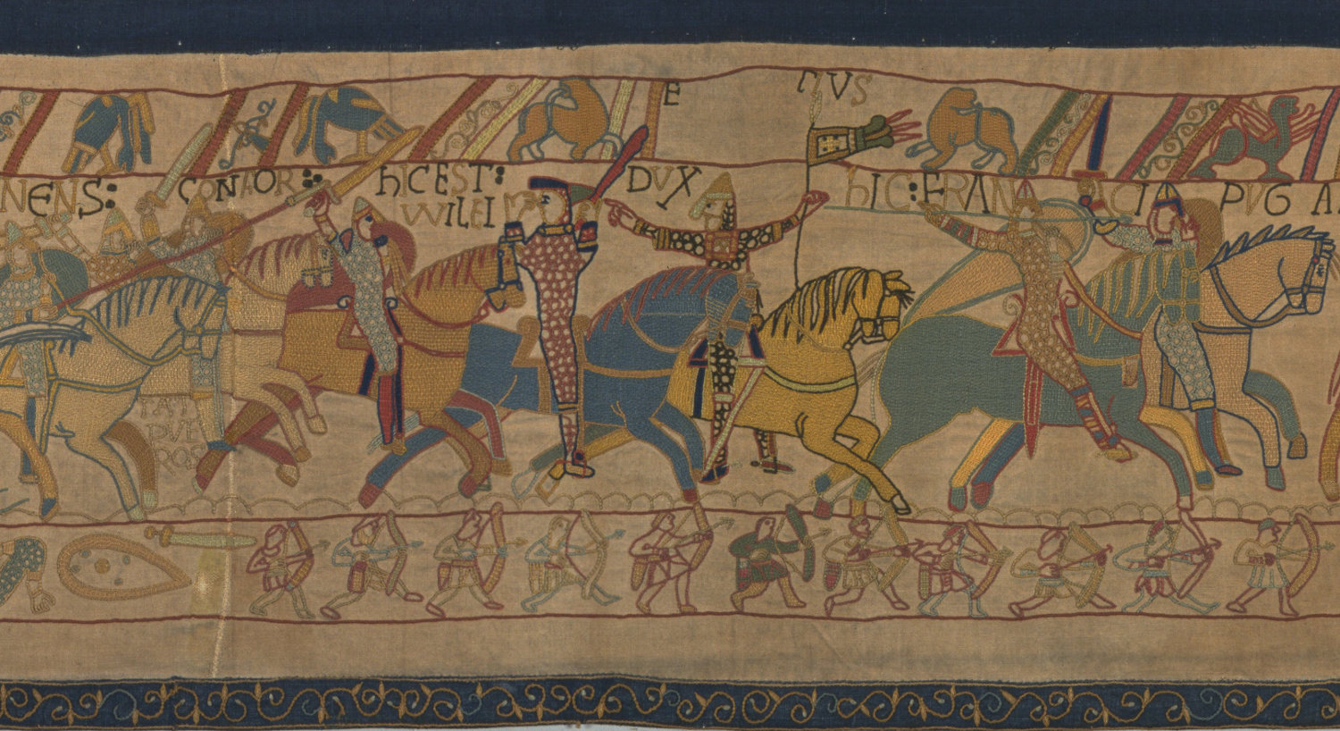
William the Conqueror on the Bayeux Tapestry. This is an image from Reading Museum's Victorian version of the tapestry
1800s - From Market Gardens to Exclusive Suburb
At the start of the 19th century, the land either side of Oxford Road (then also known as Pangbourne Road or Lane) were a mix of fields and market gardens, interspersed with the occasional larger property for the wealthier families of Reading.
During the 1800s, the land between the Oxford Road and Castle Hill to the south, which had been market gardens and nurseries, was also developed with a range of properties to house wealthy businessmen, artisans and labourers. A grid of streets gradually infilled the whole area between the two main roads.
Swallows’ Nurseries, run by James Swallow with his son William Pratt Swallow, stretched from the Tilehurst Road to the Oxford Road. From about 1815, the Swallow family started to develop their land as housing for some of Reading’s wealthiest families. Russell Street was laid out on the eastern boundary of their former market gardens linking Castle Hill to the Oxford Road, while Prospect Street linked Oxford Road and Tilehurst Road on their western boundary. Baker Street was laid out as a westward continuation of Back Lane to form the main east-west route in the new street grid. In the 1830s, Mrs. Zinzan’s fields were sold off and Waylen Street and Zinzan Street were laid out. The Jesse family were involved in many of these new developments, including Jesse Terrace.
When the Berks & Hants railway was built in 1847, building continued for the rest of the century to the west along the Oxford Road up to, and then beyond, the Reading West railway bridge. By the early 1850s, two-storey shops mixed with earlier residential terraces had largely filled the Oxford Road frontage between Howard Street and Prospect Street.
At the end of the 19th century, Reading’s elite were moving away from the area and plots began to be subdivided or large houses demolished to make way for new developments of smaller properties.
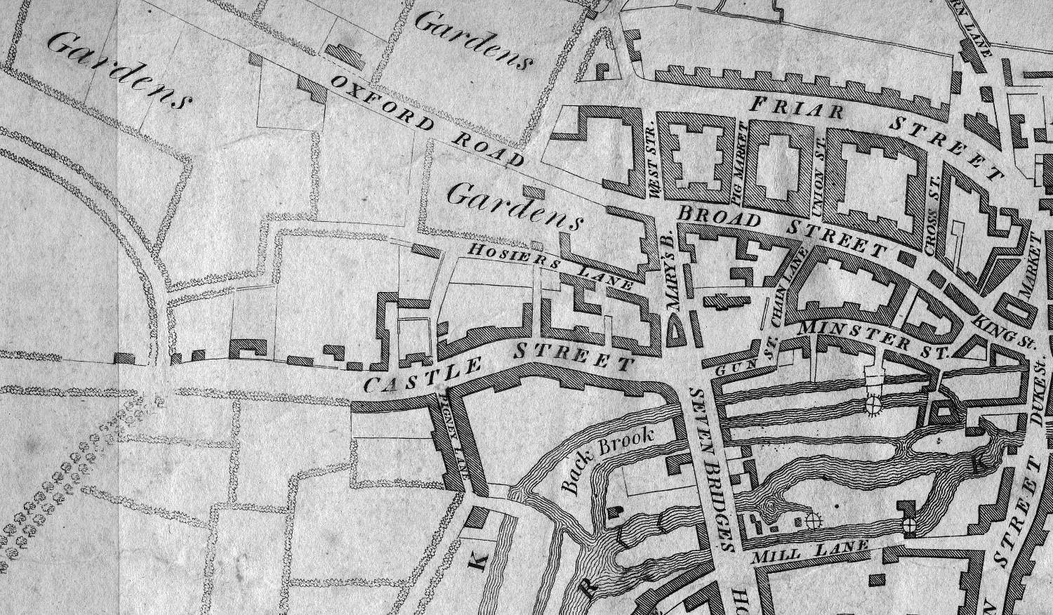
Oxford Road on 1840 map of Reading, showing the new terraced houses built by developers especially the Swallow and Jesse families
1826 - Holy Trinity Church
Holy Trinity was built in 1826 on Oxford Road with its main façade facing the newly constructed Russell Street. The Reverend George Hulme purchased the site to build a plain brick proprietary chapel (a proprietary chapel originally belonged to a private person, but with the intention that it would be open to the public). Hulme built over a gravel pit on the site in order to construct catacombs (underground burial chambers). He was counting on Reading’s wealthiest citizens paying high fees to be buried in the church’s brick burial vaults. The catacombs were sealed in 1858 but were later used as an air raid shelter during the Second World War.
The current Bath stone facade with steep gable and bell turret was added in 1845 by local architect John Billing. It became a chapel of ease for St Mary the Virgin (St Mary’s Butts) and was made a parish church in 1870.
As the population increased, further places of worship were built including a number of nonconformist churches such as the Providence Chapel on Oxford Road in about 1859, Carey Baptist Chapel in 1869, and Bridge Hall for Reading’s Open Brethren group.
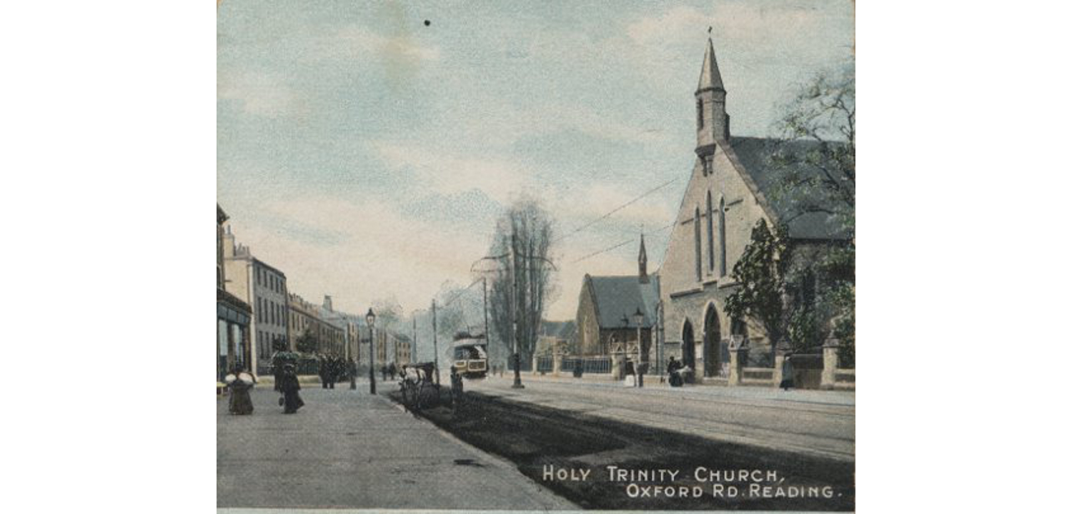
Oxford Road and Holy Trinity church, showing the main Bath stone facade, from a 1900s postcard (museum object no. 1978.440.2)
1840s - Zinzan Street
Reading's most unusual street name was created somewhere between 1840 and 1850 on land previously owned by the Zinzan family. The Zinzans are first recorded in Reading in 1514. In the seventeenth century, Henry Zinzan acquired Tilehurst Manor. His monument can be seen at St Michael's church in Tilehurst. Henry was the eldest son of Sir Sigismund Zinzan, an equerry to Queen Elizabeth I and a tournament champion.
Bridge Hall, Oxford Road by Kate Lockhart, 2013 (museum no. 2013.471.1)
1844-1847 Fox Talbot – Photography Pioneer
One of the world’s first commercial photographic studios was established at 55 Baker Street, then 8 Russell Terrace, from 1844 to 1847. It was called the ‘Reading Establishment’ and was managed by a Dutchman called Nicholaas Henneman for William Henry Fox Talbot, a pioneer of photography.
Fox Talbot had invented the first photographic process using a negative image to make a positive print. He called the images talbotypes or calotypes. Many of the images for The Pencil of Nature by Fox Talbot, the first book to be illustrated with photographic prints, were printed at the Reading Establishment. It is due to the presence of the studio in the town that Reading has some of the earliest photographs of the built environment in existence!
View Fox Talbot's print of Russell Street and Holy Trinity church.
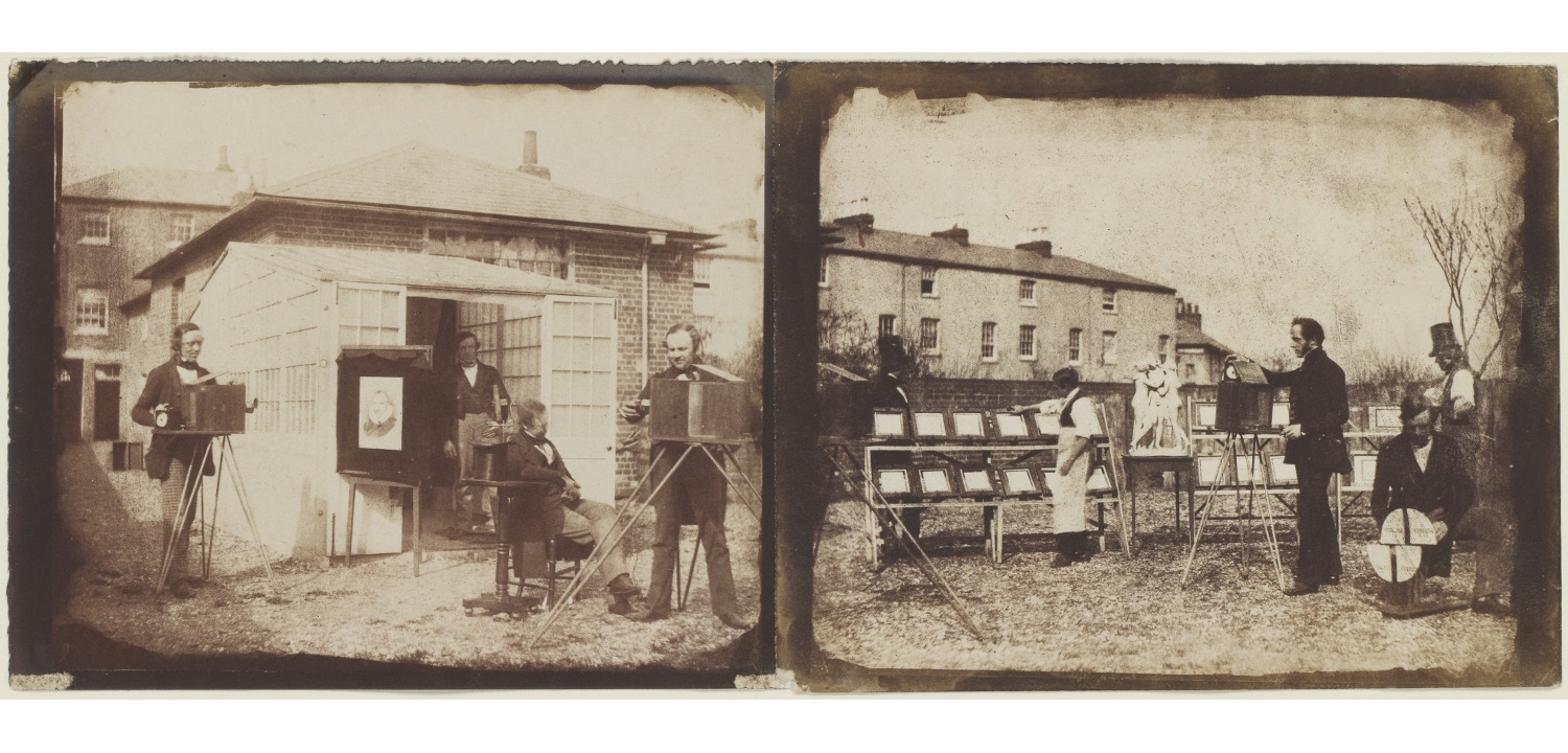
The Reading Establishment, 1846. Fox Talbot and his workers at the rear of his studio at 55 Baker Street. To the far right are the houses of 33- 35 Baker Street. Image CC0 The Met Museum
1847 - Reading West Bridge
The Great Western Railway reached Reading in 1840. The Berks & Hants Railway line passing through Reading West station was opened in 1847, although the station itself didn’t open until 1906.
The railway and the bridge were placed at a distance from the edge of town which was then near to Prospect Street. The railway bridge divides the eastern end of the Oxford Road where the properties are a mix of Georgian and early Victorian building from the more commercial, largely late Victorian and Edwardian shops further to the west.
The original 1840s brick arch of Reading West bridge was replaced in the 1930s to provide greater head clearance. Until then, top-deck tram passengers were instructed to 'Keep your seats' so not to lose their heads!
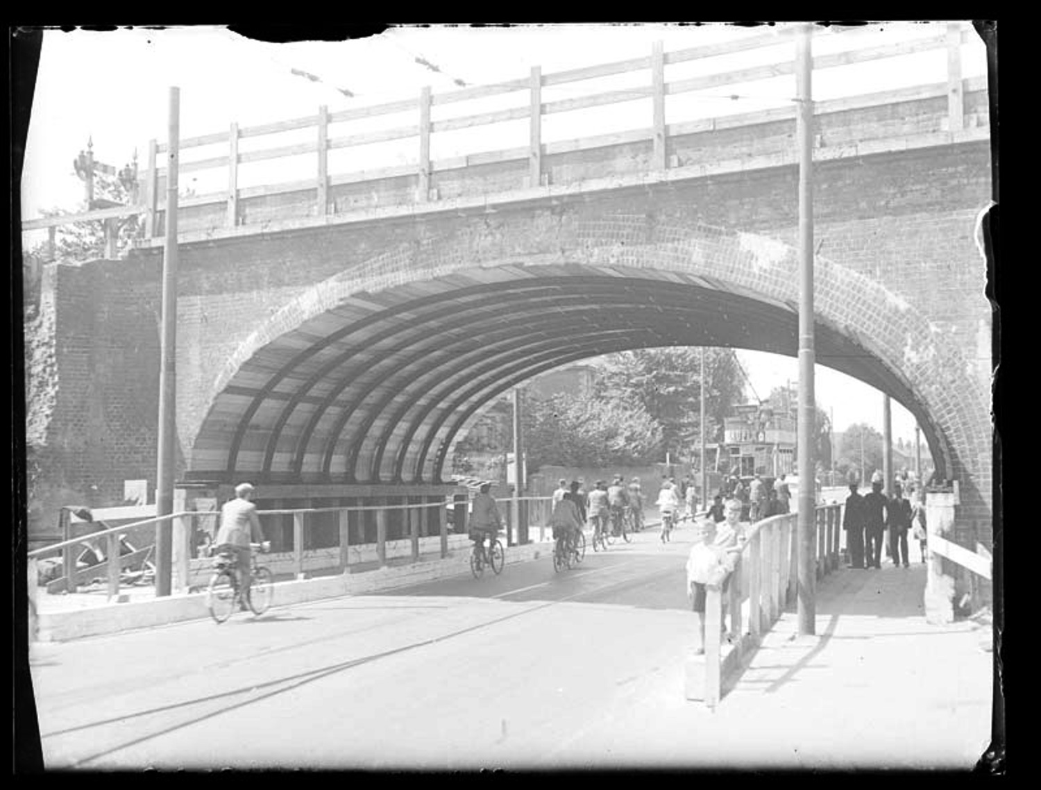
Reading West Bridge reconstruction, June 1938. Note the electric tram (museum object no. 1980.36.A65.5)
1880 - Oxford Road Community School
The Reading School Board was set up following the 1870 Forster Education Act, which required school places for all children between the ages of five and ten.
Oxford Road Board school was built in 1880-83, and was designed by local architects Morris and Stallwood in a gothic style using local red brick and tiles set behind wall and railings. It was extended by Stallwood in 1894. By 1900, there were 27 infant and junior schools run by the Borough.
Morris and Stallwood were accomplished builders of schools, combining current thinking in education and social reform with architectural skill. Of all the late Victorian schools in Reading, this is one of the most intact and architecturally inspired.
In educational terms, it comes after the first wave of post-1870 schools such as Coley and Katesgrove, and shows considerable advances in school design for its date. The schoolroom was replaced by a hall, with classrooms off it. Rooms were more adaptable, larger and lighter.
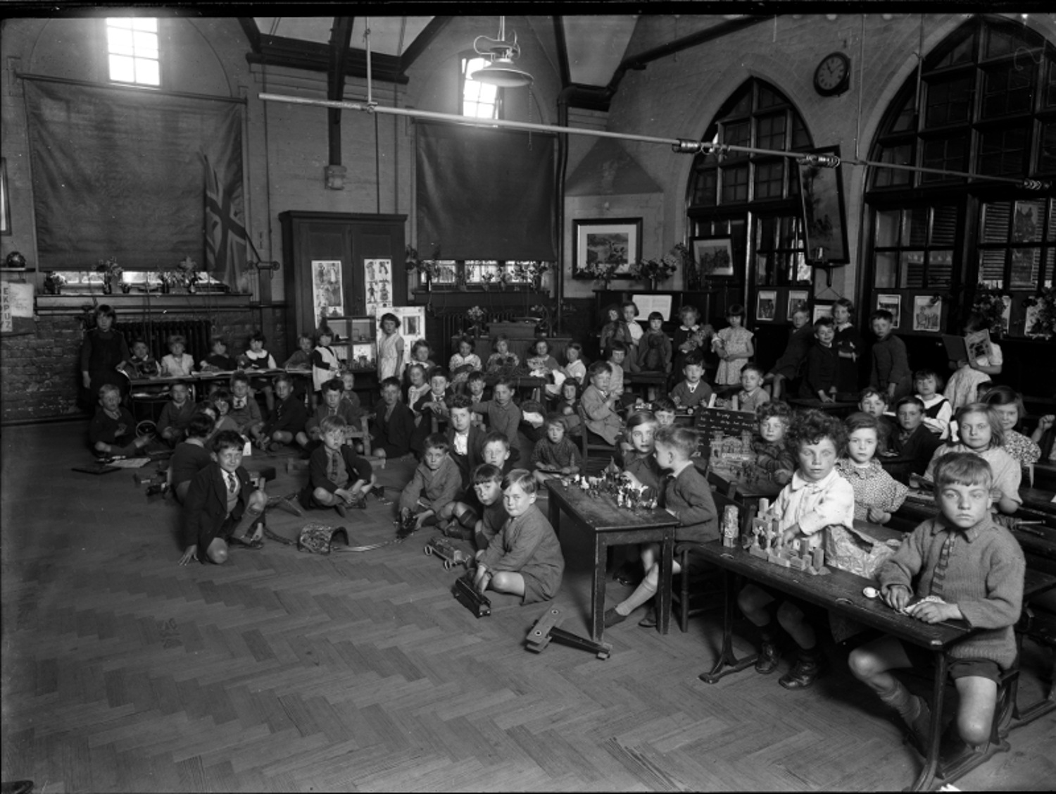
Oxford Road Infant's School - The Half-Hour's Toy-time, 1934 (museum object no. 2016.64.5)
1900 - Reading Synagogue
West Reading has long welcomed newcomers to the town. In the 19th century, many workers were moving from the countryside into Reading to find work in its new factories and industries. This in turn led to new suburbs of middle-class and working-class housing in areas like Oxford Road.
By the late 19th century, more immigrants were settling from outside the UK. The first significant group of settlers were Eastern European and Russian Jews, fleeing economic hardship and increasingly violent antisemitic persecution (particularly after the assassination of the Russian Tsar Alexander II in 1881). Many settled in Reading and founded tailoring and other businesses. Some were market traders, and one became a well-known fruiterer known as the ‘banana king’.
Oxford Road became the centre of Reading’s Jewish community, and Berkshire’s only purpose-built synagogue opened on Goldsmid Road just off Russell Street in 1900. The street is named after Sir Isaac Lyon Goldsmid who lived at Whiteknights Park in Reading. He was a financier. the Liberal MP for Reading and one of the leading figures in the Jewish emancipation in the United Kingdom.
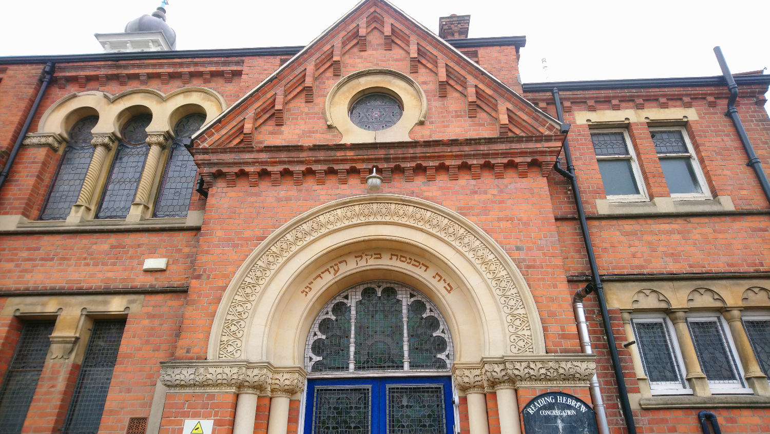
Reading Synagogue entrance
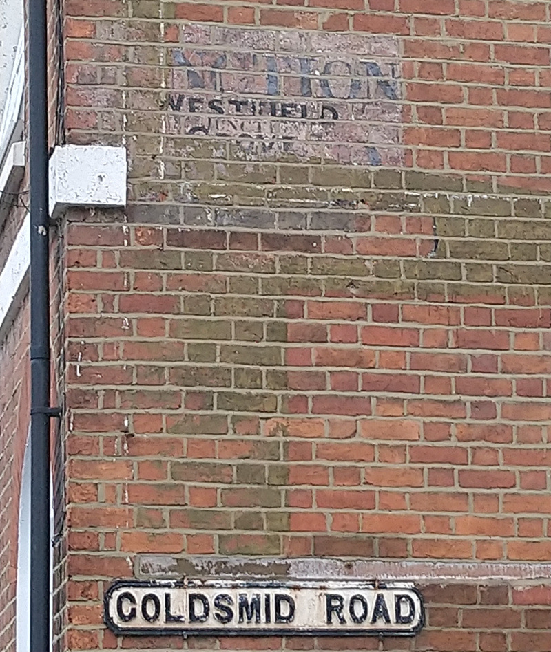
Goldsmid Road was previously called Junction Road and Westfield Grove
1929 - The Pavilion
The cinema first came to Reading in September 1904 with a showing at the Town Hall of Far East war scenes produced by the North-American Animated Photo Company. There were also local shots, including those of employees leaving the Huntley & Palmers factory. Reading's first cinema opened five years later in 1909.
The Pavilion Cinema was opened on 21 September 1929. Its site was first developed in the mid-19th century as the Clyde House School which catered for young ladies of what was then Reading’s most affluent neighbourhood. The cinema was 'specially constructed to suit the delicate requirements of talking pictures'. Its opening pictures included Show Boat starring Laura la Plante. It closed in 1979, became a bingo hall, then a snooker hall. In April 2012, the Lifespring Church purchased the property and revived its original name and also restored much of the cinema’s original art nouveau styled interior.
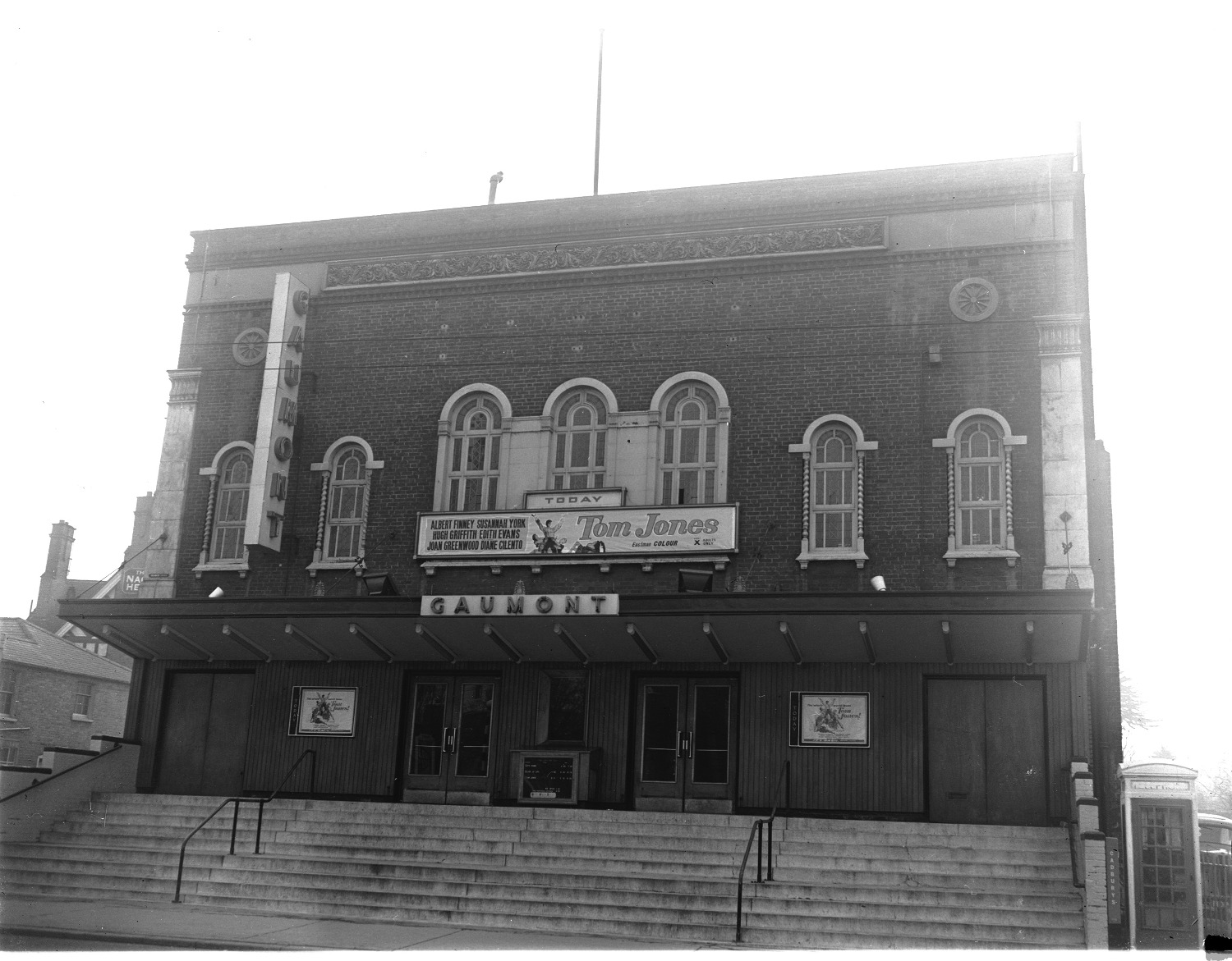
Gaumont cinema (formerly the Pavilion) in Oxford Road, 1964 (museum object no. 1980.36.D811.3)
1950s Onwards - A World in One Place
In the 1950s, Reading’s stable economy provided employment opportunities for Irish, Eastern European and Caribbean men and women who found affordable homes in the Oxford Road area. The sub-division of the large Georgian and Victorian houses for multiple occupancy increased the population of the area.
By the early 1970s, the children of this generation were growing up side-by-side with a multi-cultural perspective. In July 2012, Oxford Road residents and community leaders gathered at Battle Library to agree upon a future vision for the neighbourhood. Under the banner ‘A World in One Place’, those present recognised that the Oxford Road is amongst the most densely populated and cosmopolitan neighbourhoods in the UK.
In September 2019, it was announced that Reading was one of 69 historic high streets selected to develop plans for Heritage Action Zones. Reading's Action Zone covers parts of the conservation areas in Oxford Road, St Mary's Butts and Market Place (see the map at the bottom of this blog). Oxford Road is the priority area within Reading's High Street Action Zone. Reading Council, working with the local community and Historic England, is planning to deliver physical improvements and cultural activities to regenerate these historic high streets and restore local historic character.

Brooke Bond picture card advert, 'Flags and Emblems of the World', 1960s, printed by the Berkshire Printing Company on Oxford Road. The company was founded by Brooke Bond tea company in 1911 and closed in 2002 (museum object no. 2002.35.8)
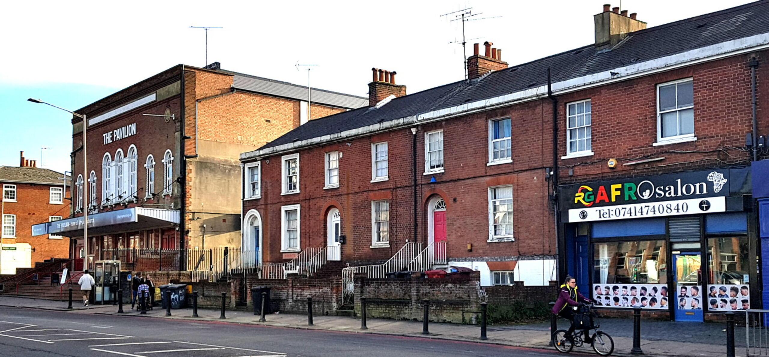
'A World in One Place' - Oxford Road 2012
The Hidden History of Oxford Road
Reading's High Street Heritage Action Zone
Find out more
Interested in learning more about the history of the Oxford Road?
Explore personal stories, memories and reflections by local people in our 2021 online exhibition: Oxford Road Stories.